Day 90: Symms Gap Campsite to Pearisburg, VA
Currently sitting in the hotel...
We survived! Now for the details. Today was bound to be easier than yesterday because 1) we didn't have to climb a ridge and 2) we got started before 1 PM. I don't have much to say about the first part of our hike...we just walked the ridge! Soon, we popped out of the woods and into a field, with plenty of pricker bushes to be had. "Pricker bush" is an umbrella term which refers to plants that I don't want touching my legs. The reward was a nice view of the valley in nearby West Virginia, and we came to Rice Field Shelter. It was good to show my mom a shelter that wasn't awful (I'm looking at you, Pine Swamp Branch). I used the privy, which was really an open throne with a privacy wall facing the shelter, and signed the shelter log. As we were getting ready to leave, a flip-flop thru-hiker named Brightside arrived. No, this isn't the same Brightside from the past few days, this one is a girl. If she catches up to the boy version of Brightside, there will be an explosion akin to a matter-antimatter reaction. I certainly don't want to be in the blast radius. Not really; they're both very nice and I'm sure they'd get along well. I've just never seen two same-named thru-hikers meet.
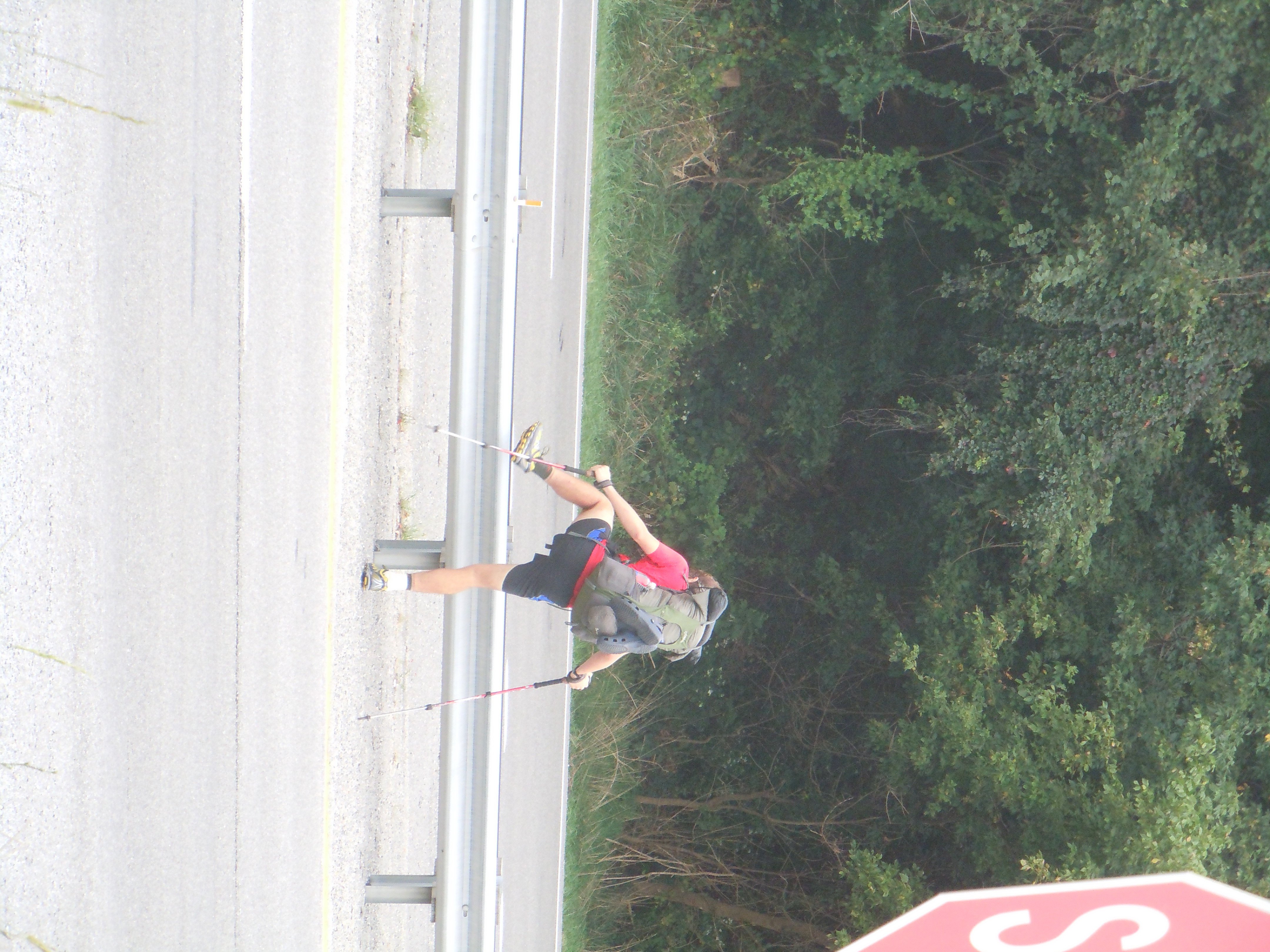
After the shelter, our hike would bring us about 1500 feet down into the valley. I knew my mom's knee was a little bad and, no surprise, she was aware as well. We took it slow on the descent and everything went pretty smoothly. At the bottom, we fixed a little low-blood-sugar problem and forged onward. We popped out near US Highway 460, and I had been following white blazes the whole time. I second guessed myself, but saw a white blaze heading northbound as well. I pulled out my phone for its GPS capabilites. After looking at the map for a bit, I surmised that the trail was still in the woods. It had been a pretty long day and I didn't know how to actually get back to the trail, so we followed a road for a few hundred yards to pick the trail up where it crossed. My AT Guide had messed up the mileage again. See, the typical AT Guide is born as a northbound edition, since most people go that direction. As far as I can tell, the producers of the book get together on the night before they send the books out, where they hastily make the necessary changes to convert the book to a southbound edition for us forgotten stepchildren. In today's episode, the guide didn't have the correct mileage to a road walk along 460. What that actually meant was that we arrived sooner than expected, which in turn meant that we got to the car sooner than expected, which meant that we were drinking soda sooner than expected. A-YO!
We dined at the mexican restaurant across the street, refueled at the Food Lion in the same parking lot, and returned to the hotel to eat ice cream. I never said that we didn't drive. Gotta love those conveniences when you have 'em. Tomorrow I'll be on my lonesome, which is bittersweet. I haven't had a day of hiking that was totally on my terms since last Friday. Since then, I've either been hiking with someone or changing my day to meet up with someone. Tomorrow will be the last of those days for the foreseeable future. I'm excited to hike straight to Damascus, one of the most famous trail towns. I'm so excited to get there, and I'm ready to put in some serious mileage again. I'm feeling healthy, so I'm like a spring that has been compressed. I can't wait to see what I can do on my own! I love the hospitality of my parents, and it's so tough to let that go, but it's time.